
Comino
Malta's kayaking high point?

Located between Malta and Gozo, is the third largest island of the Maltese archipelago, Comino. Often seen as the jewel in the Maltese tourism crown your view will be coloured by how you get there and time of the year, when you visit. Without doubt paddling across from Gozo, outside of the main tourist season is the preferred option. Depending on how much exploration you undertake whilst en route this lovely paddle is between 9 and 10 nautical miles.
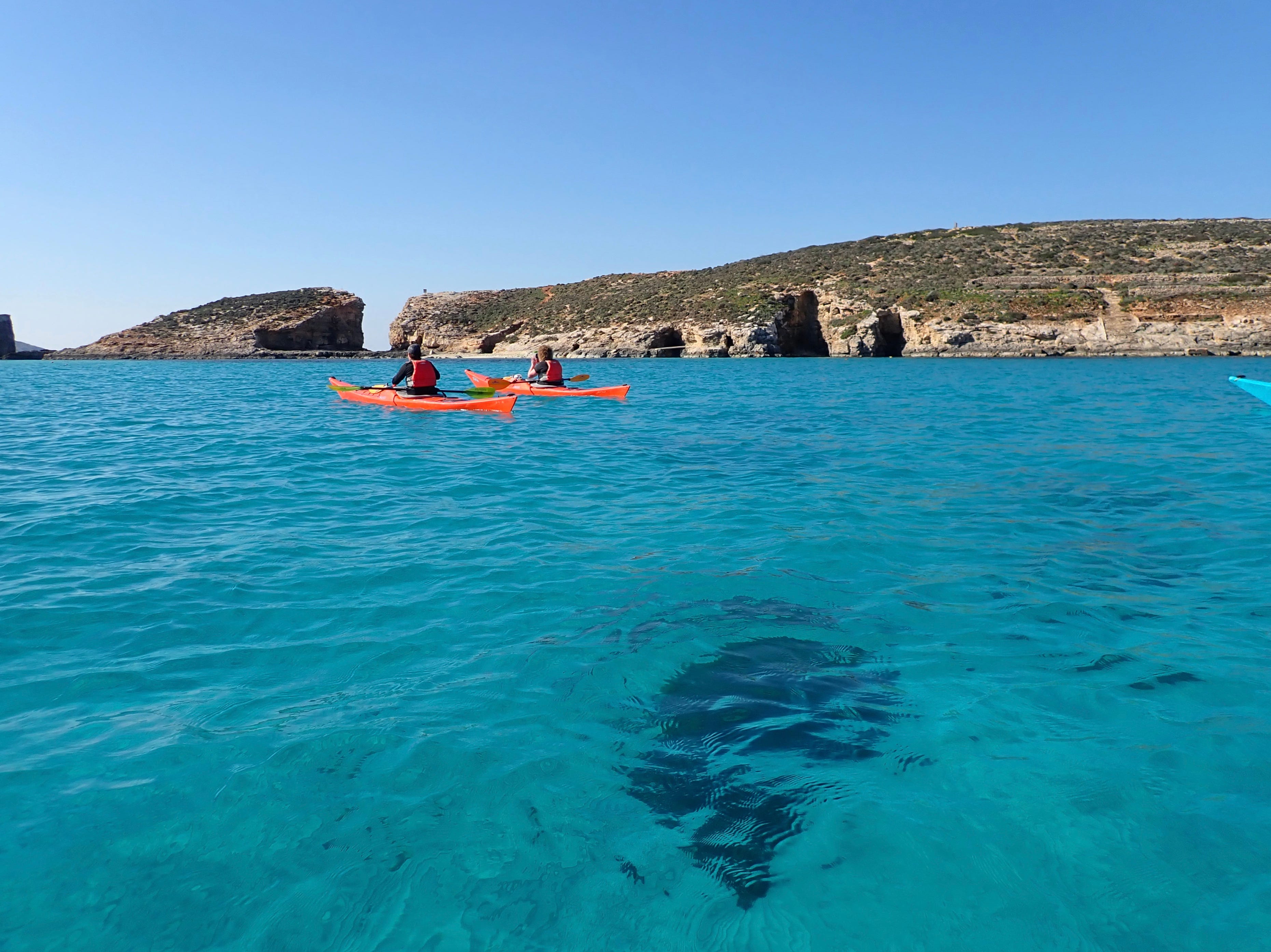
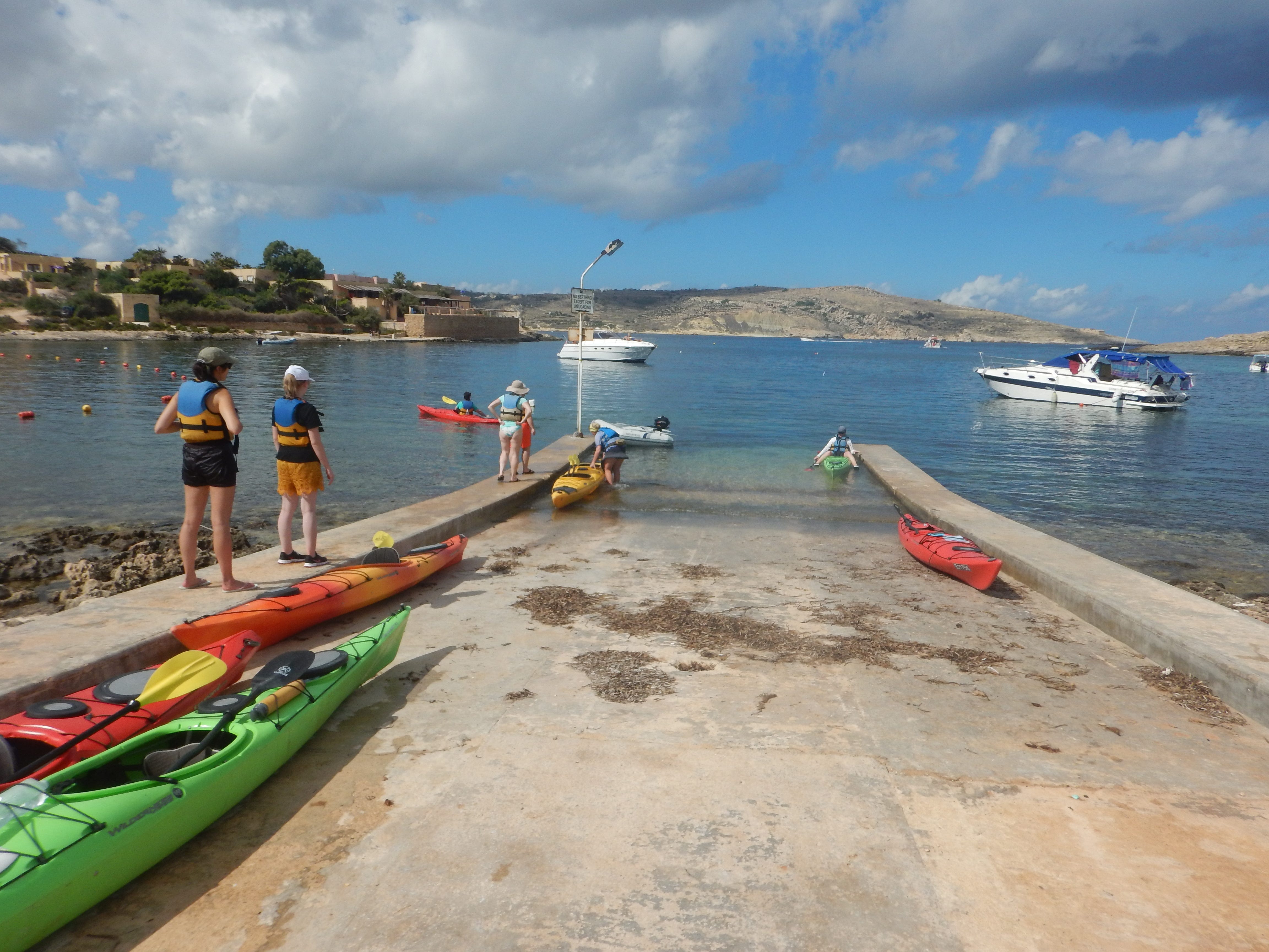
The majority of paddlers will leave from Hondoq on Gozo for the short crossing to Comino. The channel can be quite busy so its always advisable to cross following the most direct route. Once Comino is reached turn right (west) to start the circumnavigation. Pretty quickly you will arrive at the northern entrance to the Blue Lagoon, which is where those visitors arriving on commercial boats land.
When crossing the northern entrance to the Blue Lagoon extra care needs to paid due to the numerous boats that are usually entering and leaving. There are a number of navigational buoys in the area but in my experience they do not guarantee safety. Regularly I have seen boats, often traveling at speed, passing on the wrong side of a buoy. So kayak defensively in the area. In March 2020 I was close to Comino when one of the large green catamarans came around the west coast of Cominotto. There is a west cardinal mark just off the north west corner of the island and this catamaran passed to the south and east of the marker at quite some speed. If we had been paddling nearby we would definitely have stayed to the east of the buoy, out of what we thought was the shipping lane, but actually placing ourselves in quite a hazardous position.
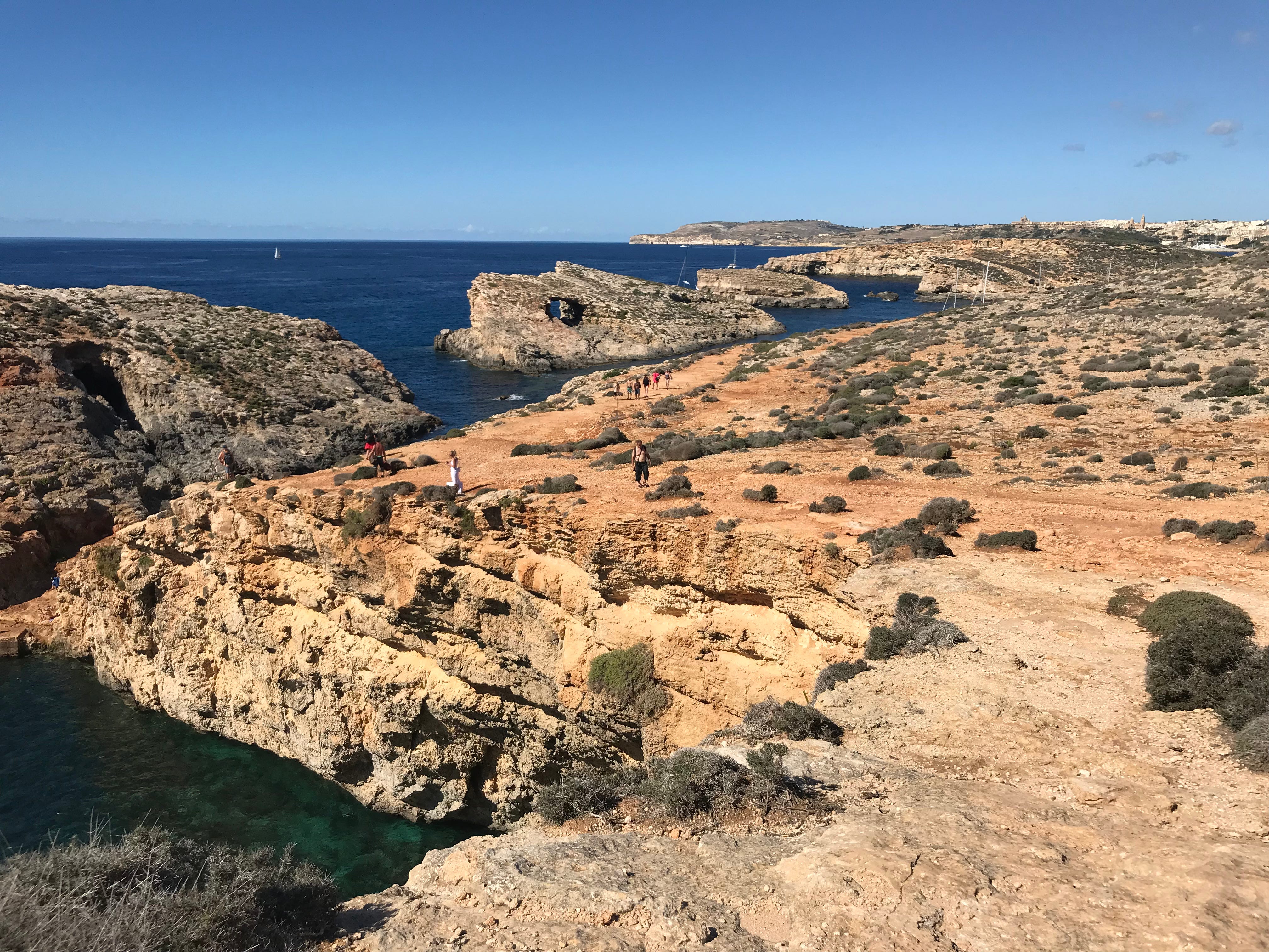
For most of the year the Blue Lagoon is off limits to kayakers, with a line of buoys marking the swimming area but in reality you would want to turn around before reaching the buoyed area because of the sheer quantity of boat traffic. Its only during the winter months when the buoys are not in place, that you will be able paddle through the Blue Lagoon, something which is highly recommended. Generally when kayaking around Comino though, it will be necessary to pass on the outside of the small uninhabited island of Cominotto.
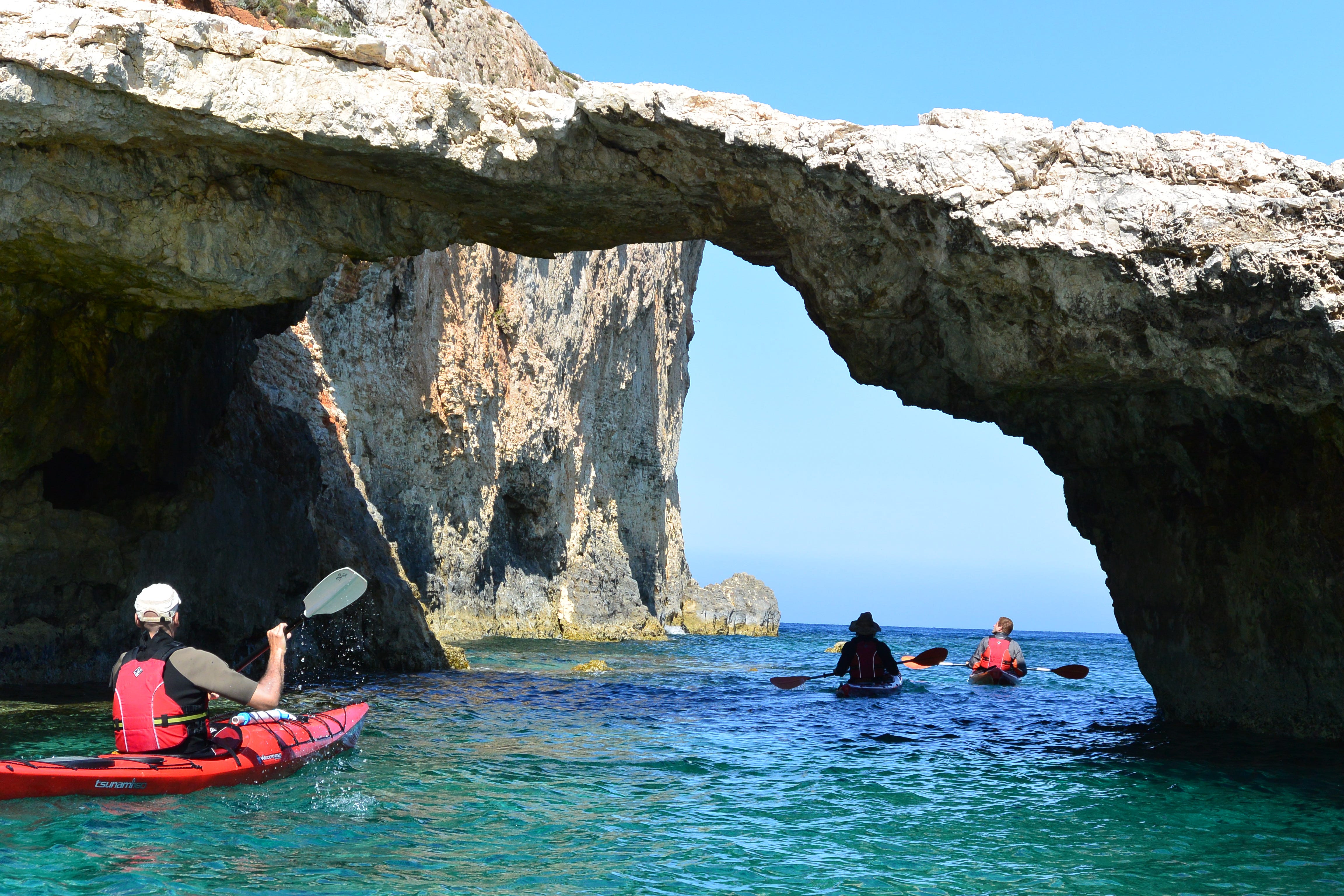
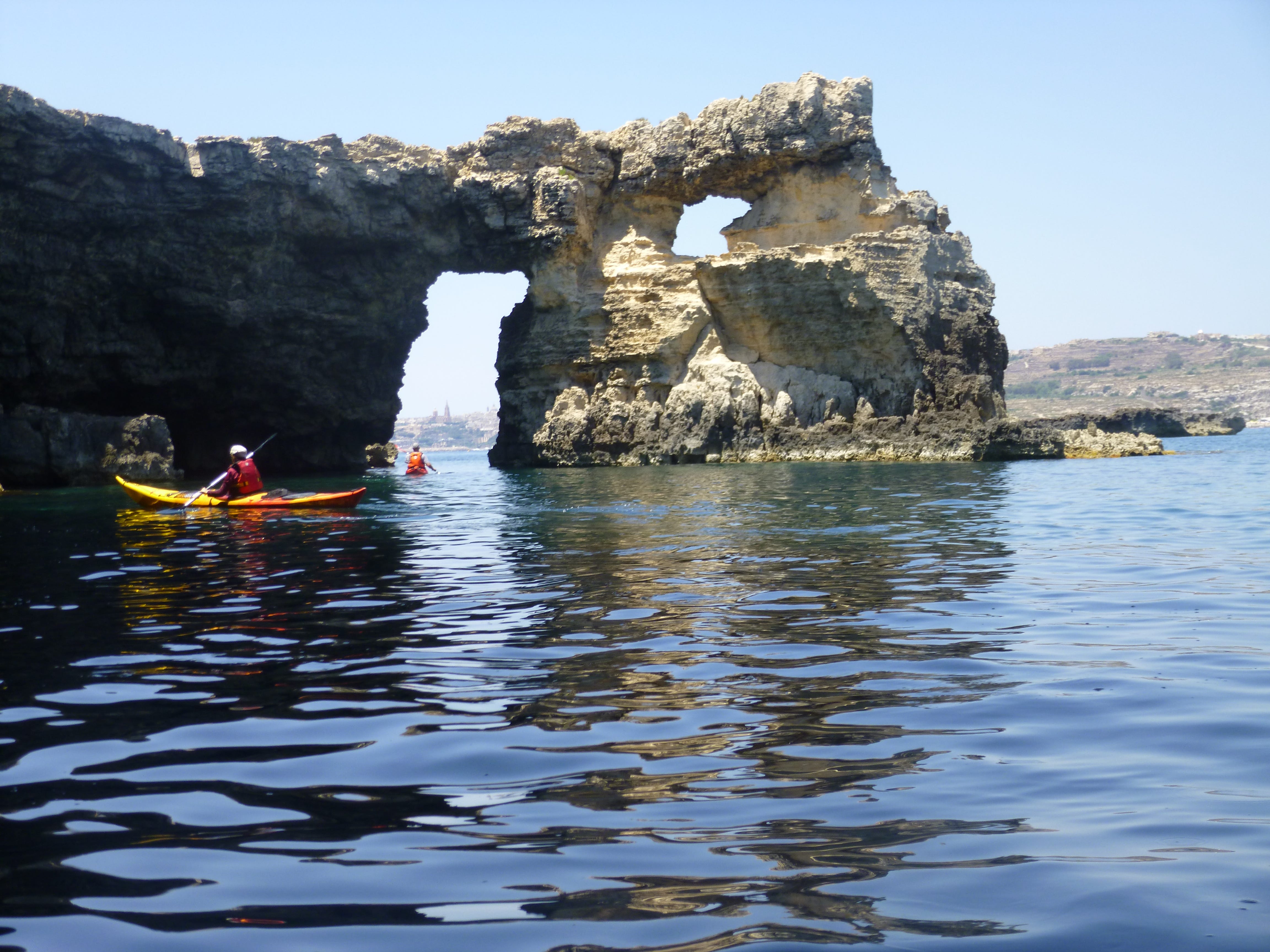
The area to the south of the Blue Lagoon contains a number of caves and arches, which provide memorable paddling. There is always the tempatation to stay and explore for a bit longer. If there is any wind, out of the west, the gaps can become quite entertaining. The further away you paddle from the Blue Lagoon the less boat traffic you will encounter.
In the Middle Ages Comino was a busy pirates den partly because of the sheltered bays and numerous sea caves. The same features, which attract us as sea kayakers. The Knights of Malta, used Comino for hunting a range of animals. The lasting feature of the Knight’s occupation of Comino, is the Santa Maria Tower, which is visible from Gozo and Malta as well as numerous locations around Comino. Whilst paddling along the southern shore it dominates the views of the coastal landscape. It was built in 1618 by Grandmaster Wignacourt, providing protection for ships using the channels between Malta and Gozo as well as allowing communication between Gozo and Malta, in case of invasion.
From the time of its construction, towards the beginning of the 17th century, up until 2002 it was used for a variety of tasks. A garrison for soldiers, as a place of imprisonment or exile for wayward Knights, the British military, an isolation hospital, a pen for farm animals and the Armed Forces of Malta. In 2002 it was given to the National Trust for Malta (Din l-Art Ħelwa), restored over the next couple of years before being opened to the public. If time allows on your visit to Comino and it is on day when it’s open then it is worth making the effort to pay a visit.
Once around Lighthouse Point the south coast stretches out before you, whilst to you right lies the north coast of Malta. There are few places to land along this section of the island, the best option is a small bay, which is approximately half a mile along the coast, which is identified by an old, slightly decaying jetty. If you do need to land the easier option is on the western side of the bay where there are the remains of a slip. Actually the best option is to just continue paddling without stopping until you reach the lunch spot.
Continuing along the south coast the most obvious feature is St Mary’s Battery or the Comino Battery, which was built to defend the channel between Comino and Malta. Built in 1715-16 it was abandoned by 1770. The battery was restored between 1996 and 1997 and again in 2003-4. Due it's relatively remote position it didn't suffer as much as some of the other fortifications and towers in the Maltese Islands. If you are walking around Comino and there is a flag flying over the battery it is an indication that it is open to the public. Underneath the battery there is a small arch, which is a great feature to paddle underneath. How long it remains in place is difficult to say as each year that I return to Comino, the arch looks more and more fragile. Will it go the same way as the Azure Window on Gozo?
The paddling along the south coast of the island is really enjoyable, always something to maintain the interest and great views. Just before the south east corner of Comino there is often a slight current flowing west, what generates the current isn’t immediately obvious as there no tides to speak of, in the Mediterranean.
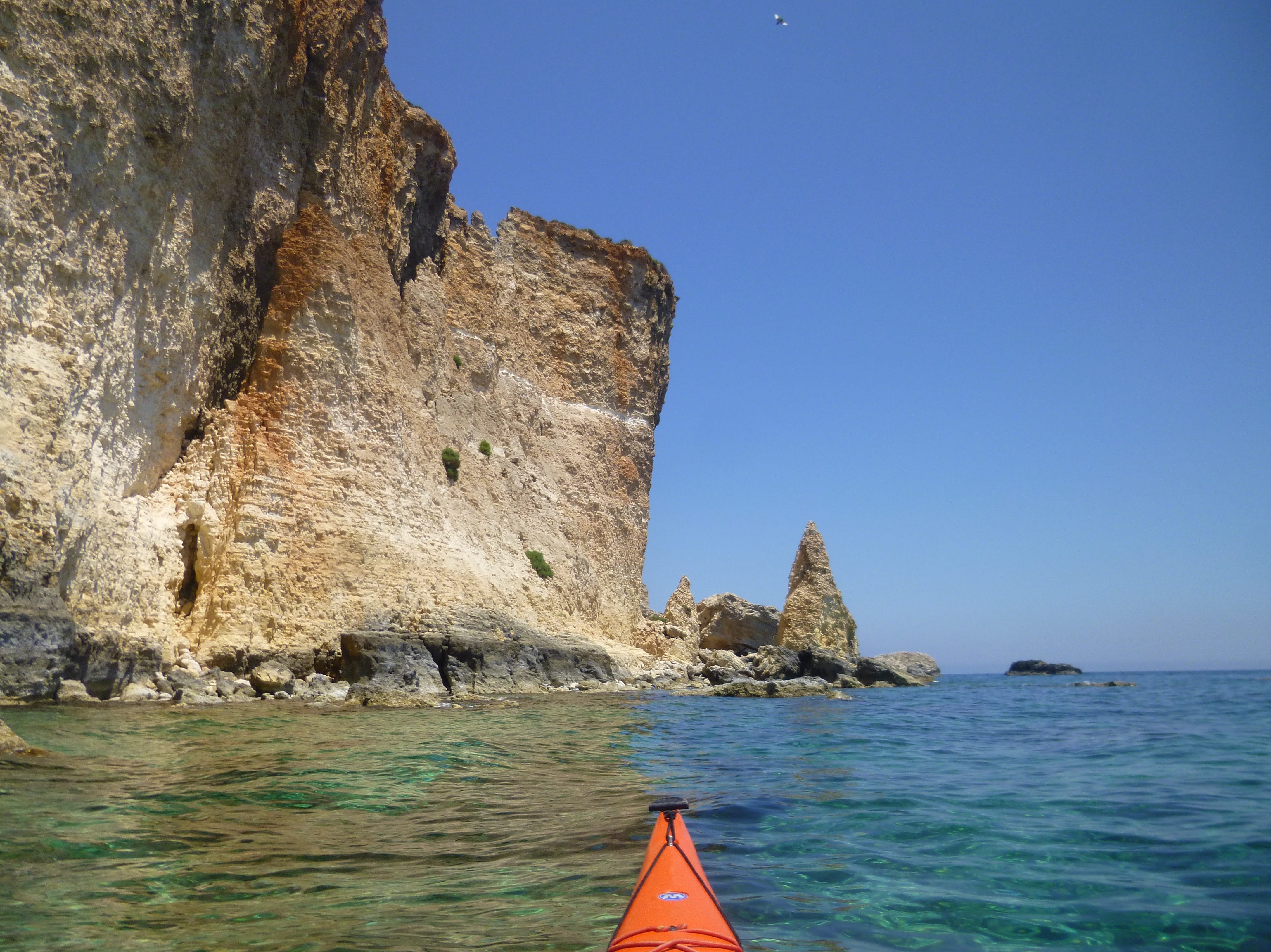
Paddling around the south east corner of the island a spectacular landscape is revealed. Vertical cliffs and spiky offshore stacks, with the coastline of Gozo behind. Along the eastern shore there is plenty to interest the paddler, this is a mile to be savoured rather than rushed. One of the most obvious is Id-Darsa, (the Molar) although it actually looks more like an elephant’s trunk as opposed to a tooth. I always enjoy paddling along the east coast because there are a number of possible routes depending upon the sea conditions and the confidence and skill level of the paddlers in the group.
In the final bay before the north easterly point there are a number of caves, some of which are pretty large and can easily accommodate a whole group of kayakers. There are often dive boats and tourist vessels in the bay, so remember to be boat aware. On the northern side of the bay there is a small “smugglers” cave, there is access from the cliff top above through some small tunnels, ending in a small ledge. In the past I have jumped off the ledge, swimming around the small headland before exiting the water, relatively easily. Probably best to do in summer.
Comino is often described as a bird reserve ( there is a bird ringing station on the island) and an important environmental location. It is one of the few places in Malta where hunting is not allowed. A visiting bird watcher from northern Europe will see a range of species, which are guaranteed to be found interesting such as Scopoli’s Shearwater. The Black Whip Snake, which can reach 2 metres in length is found on Comino. Luckily I have never seen one whilst visiting, they are supposedly very lively and can strike out.
Santa Marija Bay on the north coast of Comino is one of the most suitable places to break your paddle around the Island. There is a slip in the rear of the bay but be very careful when landing and launching. In common with so many other boat launching ramps in the archipelago it is really slippy. Also don’t just abandon the kayaks on the slip, move them to one side so that other users aren’t inconvenienced. There is also a pleasant beach just to the west of the slip, which is a great place to pass some time, especially after the obligatory lunch time swim.
When leaving Santa Marija Bay head towards the north westerly point of the bay, where there are a few interesting passages to explore.
Most groups will be crossing back to Hondoq, after a really enjoyable day on the water. Make sure that you don’t let your guard down whilst crossing or allow the group to become to split up. There will be a number of boats, of a variety of sizes crossing your path and generally you will have to give way. Be particularly careful of any boats with inflatable rides. I have seen them operating with just a driver, who spend most of their time looking backwards. Contrast this to the U.K. , where such boats need a driver and a spotter. Being hit by an inflatable donut, would not be a good way to end what has without doubt been a thoroughly enjoyable day.
All that is left to do is to leave the water at Hondoq, without causing too much disruption on the slipway before heading to the cafe, if it is open, for a celebratory Cisk or banoffee flavoured ice cream. No matter how many times I paddle around Comino I never fail to enjoy it. A delightful day out.
These are the GPS co-ordinates for a number of major points on the journey:
Hondoq N36°01.664’ E014°19.403’
Santa Marija Bay N36°00.992’ E014°20.262’
SE Comino N36°00.384’ E014°20.910’
Blue Lagoon N36°00.802’ E014°19.416’
Cominotto W N36°00.756’ E014°19.065’
Lighthouse Point N36°00.227’ E014°19.464’
These shouldn’t be used for navigational purposes by larger craft, as they indicate a point for sea kayakers to enjoy the coast, rather than a safe position for larger vessels in deep water.