

Paddle to Cézembre

As the ferry approaches St Malo, the complexity of the offshore reefs and islets provide inspiration for any sea kayaker who is gazing across the Breton seascape. The largest of the islands is Cézembre, identified by its south facing sandy beach. It is reputed to be the only beach, which faces in that direction, in this area of Brittany.
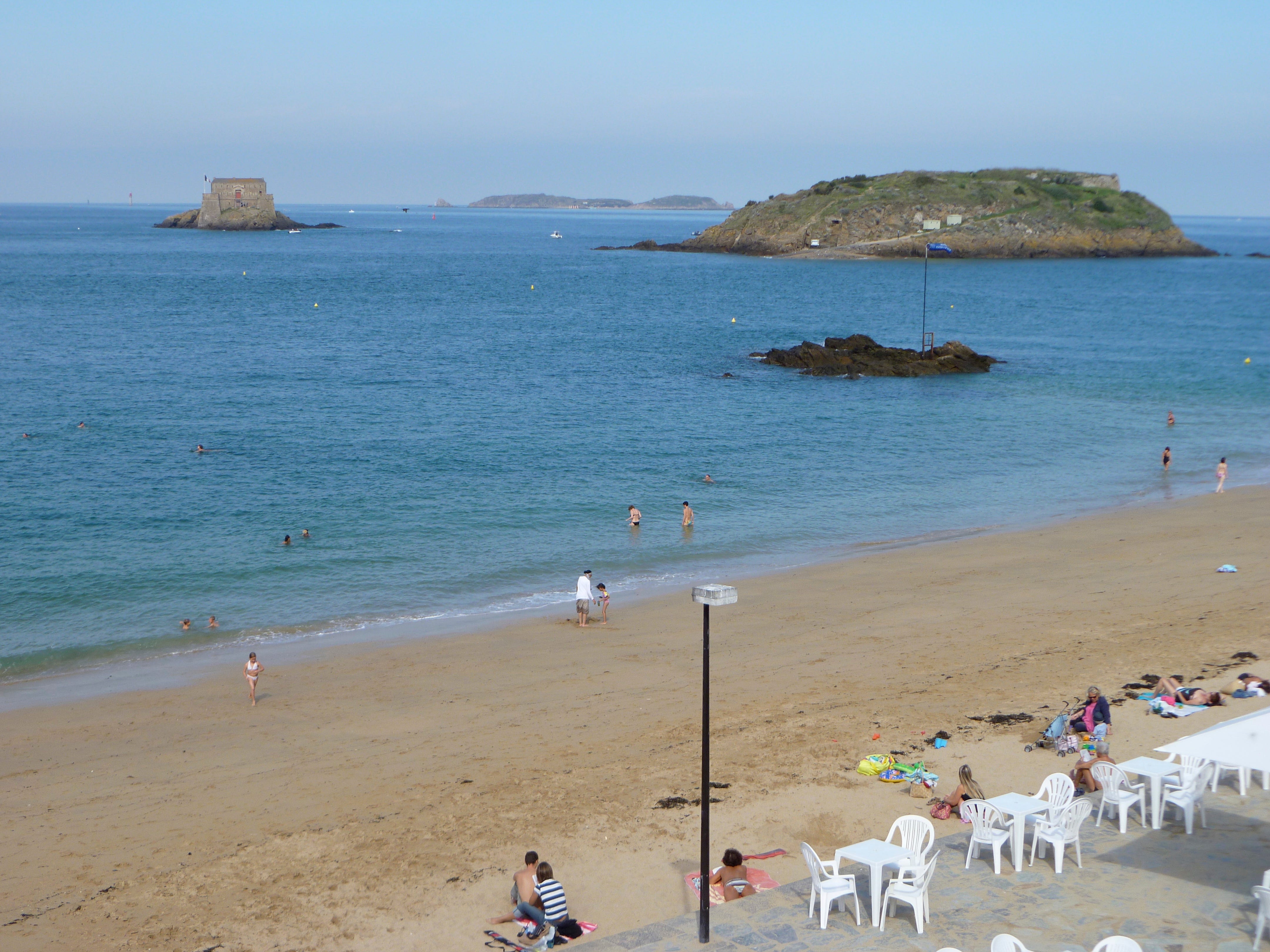
We have always launched from St Servan, it is an easy place to leave from with the campsite only a couple of hundred metres away, so if necessary it is possible to drop off the kayaks before returning the cars to the relative security of the campsite. For those new to this area the defining feature is the size of the tides, some of the largest in the world with a range reaching 14 metres on some Springs. Such a large vertical change will result in significant lateral movements. So the key to a stress free paddle is prior planning. Inaccurate planning can result in some seriously long carries.
There is also easy launching in the marina at St Servan, where there is parking close to the car ferry terminal, requiring payment, but it is convenient. Adjoining the car park there is a large slipway, which can be busy at times with a variety of water users. This was our chosen point of departure, this weekend.
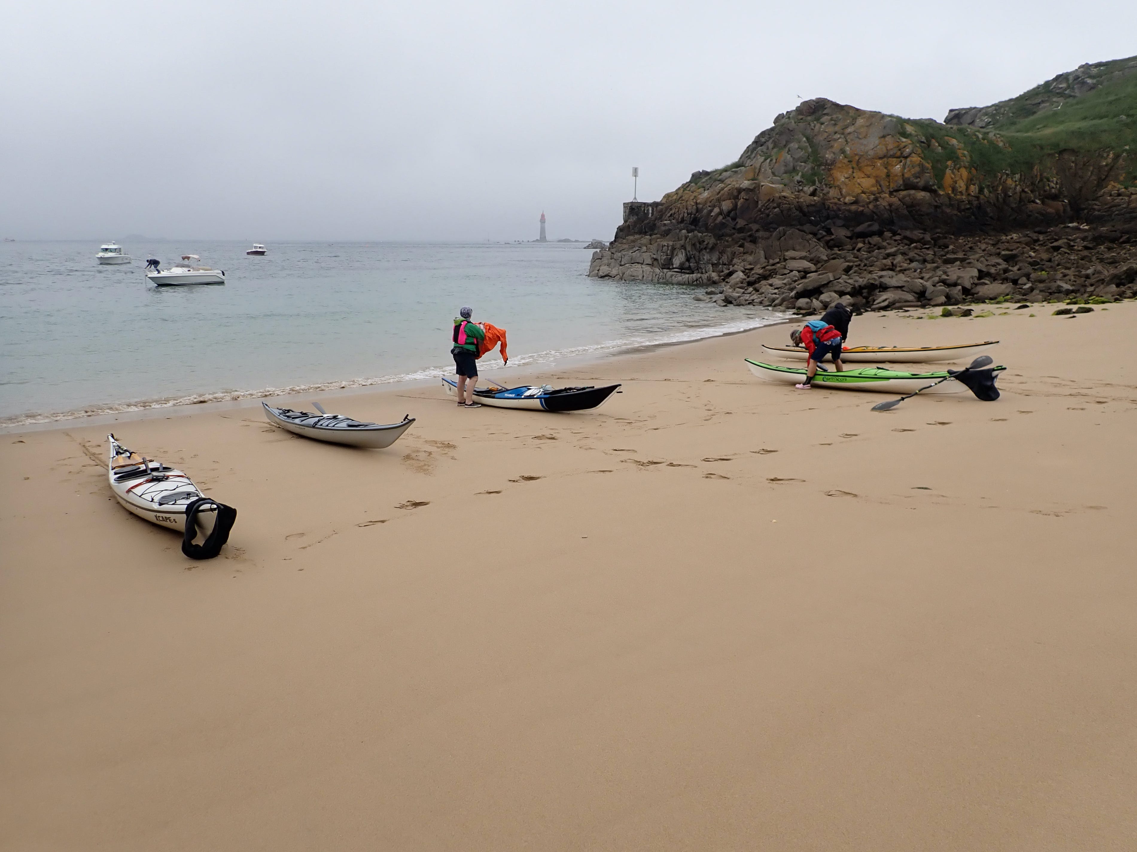
Paddling out to Cézembre requires a thorough understanding of buoyage, the waters in this area are busy, with both leisure and commercial craft, and it helps to know where they are heading. Remember to cross shipping channels at right angles and if your command of the French language is up to it, monitor the appropriate radio frequency.
Hermits are thought to have occupied the island in the 12th century, and later on a monastry and several chapels were built on the island. Towards the end of the 17th century, military fortifications were built on Cézembre, with the island retaining this function until the end of World War 2.
One of the key phases in the history of Cézembre, was the Battle of St Malo, in August and September 1944. Nearly 40,000 Allied bombs were dropped on this small island, before the combined German-Italian garrison surrendered on the 2nd September. On the 31st August 1944, 300 heavy bombers, both American and British, attacked the island. When the German’s eventually surrendered, amazingly, they seem to have only suffered quite light casualties.
I first paddled to Cézembre in June 1991 and I remember being shocked by the extent of the devastation, nearly 47 years after the event. Interestingly, when I have visited the island since 1991, the area which we have been able to explore has gradually shrunk. Wire fences have appeared, exclaiming the dangers of unexplored ordnance, whilst allowing a number of birds to increase their breeding populations. Both Guillemots and Razorbills have returned to breed since my first visit, 32 years ago.

In contrast to the sandy beach of the south coast, the northern side of the island is dominated by wave swept cliffs. The swell, rolling in from the north west and breaking on these cliffs, often bounces back to sea, creating conditions more challenging than might be expected.

Paddling back towards St Malo it is hard to imagine that until approximately 500 years ago it was possible to walk from St Malo, out to Cézembre, through a large salt marsh. Today it is a busy shipping lane, although in places quite narrow. Remember to look both ways when crossing between the lateral buoys.

After visiting St Malo and considering the impact of the German occupation I would recommend the beautifully written book, “All The Light We Cannot See” by Anthony Doerr.
So next time you are in this area of northern Brittany, with your kayak, try to schedule a paddle to this small island, with a fascinating history.